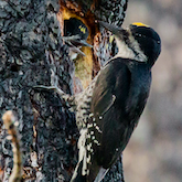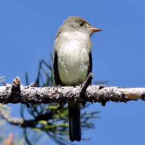


Residents of California, Oregon and Washington may think of the Hermit Warbler as "their warbler." After all, this tiny bird with the bright yellow face only breeds in tall coniferous forests in these 3 states, often returning to the same territories year after year. But in reality, the Hermit Warbler is more of a summer tourist. These neotropical migrants spend the majority of their lives in Mexico and Central America (save for a small oddball population that winters on the central California coast.) They come north for the all-you-can-eat insect buffet, make some babies, then pack up the family and head home.
But exactly where is home, and who are their neighbors there? Do the Hermit Warblers that breed in the same area, say Crane Flat in Yosemite National Park, all spend the winter together in the same area as well? Or do they share their non-breeding habitat with Hermit Warblers that breed in Washington and Oregon? These questions relate to "migratory connectivity," which is defined by the Migratory Connectivity Project as "the geographic linking of individuals and populations between one life cycle stage and another." In other words, where do they go and how do populations mix (or not mix) along the way?
Understanding migratory connectivity is crucial for conservation. For instance, Hermit Warbler breeding populations show variable trends; some are increasing, while others decrease. Is this due to changes in habitat or other factors in the breeding range? Or are these trends the result of something happening in their non-breeding habitat? To figure that out, you need to know where Hermit Warblers go. But how do you track a bird that weighs only about as much as two nickels on a journey of over 2,000 miles?
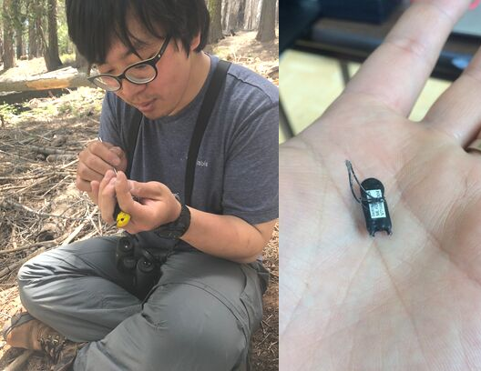
One way is to use "geolocators"– a type of tracking device that Hankyu Kim, a Ph.D. candidate at Oregon State University, is using to track Hermit Warblers through their entire migratory cycle. Kim's dissertation research focuses on migratory connectivity and, with collaboration from IBP and other partners, he is putting geolocators on Hermit Warblers throughout their breeding range. This past June, IBP helped him put geolocators on some Hermit Warblers in Yosemite National Park, where IBP has been capturing, banding, and releasing birds at Monitoring Avian Productivity and Survivorship (MAPS) stations for thirty years.
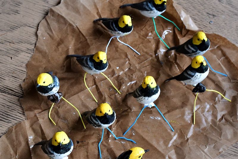
A flock of Hermit Warbler (decoys) Kim made to help with target netting. Photo courtesy of Hankyu Kim.
"Our MAPS station at Crane Flat in Yosemite has really good habitat," says Helton. "They were abundant enough out there that we could find places where the male Hermit Warblers were singing, set up a net with a decoy and start the playback, and often within 5-10 minutes we'd catch that individual, and sometimes two or three others from bordering territories."
"The geolocators were tiny - about the size and dimensions of my pinky fingernail," says Helton "Each had a loop of thin but durable black cord on the long sides, resulting in an object roughly the shape of an 8 with the geolocator itself in the very middle. The bird's legs go through the loops and then the geolocator sits on top of the bird's hips like a tiny backpack." But that "backpack" can't be too heavy, because you don't want the geolocator to impact the bird's behavior or health. So the geolocator only weighs as much as a small paperclip.
So how does such a tiny device track a bird's location? Simply by recording light levels and comparing them to an internal clock. The timing of sunrise (relative to a standard clock) gives an estimate of longitude, and latitude can be estimated by day length. Geolocators consist of simply a light sensor, internal clock, tiny battery and a miniature computer; so they can be compact and lightweight- just 0.4 grams. Unfortunately, their tiny size doesn't allow for data transmission, so retrieving the data from the geolocators will require Kim and IBP to recapture the same birds next year – when they will remove the devices and download a year’s worth of data.
Kim began putting out geolocators in the summer of 2018. Of the approximately 60 Hermit Warblers he put geolocators in Oregon on that summer, he was able to recapture 12 of them in the summer of 2019. He's just beginning to download and analyze those data, but the first warbler he's looked at appears to have spent the winter in the mountains of eastern Mexico. During the 2019 summer Kim put out 115 geolocators.
And some of the geolocators he put out at Crane Flat made an early reappearance. A couple of weeks after the trip, Kim received an email from Amy Hogan, one of IBP’s bird banders in Yosemite: "We had some repeat visitors when we banded at Crane Flat this past week! Happy to report these lil' guys were healthy and still carrying around their backpacks for you," wrote Hogan.
Working alongside IBP’s MAPS crew not only saved time, it also gave Kim extra insight into the ecology of the birds in his study. "IBP's long history of monitoring in Yosemite will provide even more information about Hermit Warblers," says Kim. "Several of the birds we caught had been banded in previous years at the MAPS station, so we could tell their age, and other background information." And if these Hermit Warblers are recaptured by IBP’s MAPS banders in the summer of 2020, they can retrieve the geolocators for Kim!